Northwood, NH
 | Community Contact | Town of Northwood
Neil Irvine, Town Administrator
818 First NH Turnpike
Northwood, NH 03261 |
| Telephone | (603) 942-5586 x2020 |
| Fax | (603) 942-9107 |
| E-mail | nirvine@northwoodnh.org |
| Web Site | www.northwoodnh.org |
| Municipal Office Hours | Town Hall, Selectmen Office: Monday through Thursday, 9 am - 4 pm; Town Clerk, Tax Collector: Monday-Thursday 8:30am-4pm, Saturday 1st & 3rd of each month 8:30am-11:30am unless noted change on website |
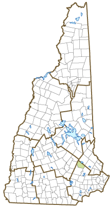
| County | Rockingham |
| Labor Market Area | Raymond, NH LMA |
| Tourism Region | Merrimack Valley |
| Planning Commission | Strafford Regional |
| Regional Development | Regional Economic Development Corp. |
| Election Districts | |
| US Congress | District District 2 |
| Executive Council | District District 4 |
| State Senate | District District 17 |
| State Representative | Rockingham County District 1 |
| Incorporated: 1773 |
| Origin: This territory was first settled in 1763, and known as the North Woods, a parish of Nottingham. It was incorporated as a separate town upon agreement with Nottingham in 1773. In 1791, the General Court of New Hampshire authorized a committee to survey and lay out a road between Durham and Concord, which became the First New Hampshire Turnpike. The road runs the length of Northwood, and the town's many taverns accommodated travelers. At one time, there were some 12 sawmills in the town, five of which were replaced by shoe factories. |
| Villages and Place Names: Northwood Center, Northwood Narrows, Northwood Ridge |
| Population, Year of the First Census Taken: 744 residents in 1790 |
| Population Trends: Population change for Northwood totaled 2,489 over 41 years, from 2,175 in 1980 to 4,664 in 2021. The largest decennial percent change was a 44 percent increase between 1980 to 1990. The 2021 Census estimate for Northwood was 4,664 residents, which ranked 81st among New Hampshire's incorporated cities and towns. |
| Population Density and Land Area, 2021 (US Census Bureau): 165.8 persons per square mile of land area. Northwood contains 28.1 square miles of land area and 2.1 square miles of inland water area. |
| Municipal Services |
|---|
| Type of Government | Selectmen |
| Budget: Municipal Appropriations, 2019 | $10,342,335 |
| Budget: School Appropriations, 2020-2021 | $11,680,919 |
| Zoning Ordinance | 1968/17 |
| Master Plan | 2004 |
| Capitol Improvement Plan | Yes |
| Industrial Plans Reviewed By | Planning Board |
| Boards and Commissions | |
| Elected: | Selectmen; Planning; Budget; Cemetery; Library; Police; Trust Funds |
| Appointed: | Conservation; Cable; Emergency Management; Highway; Recreation |
| Public Library | Chesley Memorial |
| Emergency Services |
|---|
| Police Department | Full-time |
| Fire Department | Full & part-time |
| Emergency Medical Service | Full & part-time |
| Nearest Hospital(s) | Distance | Staffed Beds |
| Frisbie Memorial, Rochester | 17 miles | 23 |
| Concord Hospital, Concord | 20 miles | 238 |
| | |
| Utilities |
|---|
| Electric Supplier | Eversource Energy; NH Electric Coop |
| Natural Gas Supplier | None |
| Water Supplier | Northwood Ridge Water District; Private wells |
| Sanitation | Private septic |
| Municipal Wastewater Treatment Plant | No |
| Solid Waste Disposal |
| Curbside Trash Pickup | Private |
| Pay-As-You-Throw Program | No |
| Recycling Program | Mandatory |
| Telephone Company | Consolidated Communications; Metrocast |
| Cellular Telephone Access | Yes |
| Cable Television Access | Yes |
| Public Access Television Station | Yes |
| High Speed Internet Service: |
| Business | Yes |
| Residential | Yes |
| (NH Dept. of Revenue Administration)Property Taxes |
|---|
| 2021 Total Tax Rate (per $1,000 of value) | $15.47 |
| 2021 Equalization Ratio | 78.5 |
| 2021 Full Value Tax Rate (per $1,000 of value) | $11.96 |
| 2021 Percent of Local Assessed Value by Property Type |
| Residential Land and Buildings | 85.5% |
| Commercial Land and Buildings | 12.5% |
| Public Utilities, Current Use, and Other | 2.0% |
| (ACS 2016-2020)Housing |
|---|
| Total Housing Units | 2,200 |
| Single-Family Units, Detached or Attached | 1,749 |
| Units in Multiple-Family Structures: | |
| Two to Four Units in Structure | 119 |
| Five or More Units in Structure | 56 |
| Mobile Homes and Other Housing Units | 276 |
(US Census Bureau)Population
(1-year Estimates/Decennial) |
|---|
| Total Population | Community | County |
| 2021 | 4,664 | 316,947 |
| 2020 | 4,641 | 314,430 |
| 2010 | 4,241 | 295,223 |
| 2000 | 3,656 | 278,748 |
| 1990 | 3,127 | 246,744 |
| 1980 | 2,175 | 190,345 |
|
| Demographics, American Community Survey (ACS) 2016-2020 |
|---|
| Population by Gender |
| Male: 1,989 | | Female: 2,327 |
| Population by Age Group |
| Under age 5 | | 227 |
| Age 5 to 19 | | 611 |
| Age 20 to 34 | | 768 |
| Age 35 to 54 | | 1,100 |
| Age 55 to 64 | | 682 |
| Age 65 and over | | 928 |
| Median Age | | 44.5 years |
| Educational Attainment, population 25 years and over |
| High school graduate or higher | | 94.8% |
| Bachelor's degree or higher | | 34.6% |
| (ACS 2016-2020)Income, Inflation Adjusted $ |
|---|
| Per capita income | $39,479 |
| Median family income | $115,186 |
| Median household income | $94,141 |
| Median Earnings, full-time, year-round workers, 16 years ad over |
| Male | $60,417 |
| Female | $47,438 |
| Individuals below the poverty level | 7.0% |
| (NHES - ELMI)Labor Force |
|---|
| Annual Average | 2011 | 2021 |
| Civilian Labor Force | 2,480 | 2,640 |
| Employed | 2,326 | 2,558 |
| Unemployed | 154 | 82 |
| Unemployment Rate | 6.2% | 3.1% |
| (NHES - ELMI)Employment & Wages |
|---|
| Annual Average Covered Employment | 2011 | 2021 |
| Goods Producing Industries |
| Average Employment | 159 | 165 |
| Average Weekly Wage | $723 | $1,046 |
| | |
| Service Providing Industries |
| Average Employment | 646 | 835 |
| Average Weekly Wage | $662 | $855 |
| | |
| Total Private Industry |
| Average Employment | 805 | 1,000 |
| Average Weekly Wage | $674 | $886 |
| | |
| Government (Federal, State, and Local) |
| Average Employment | 192 | 174 |
| Average Weekly Wage | $664 | $793 |
| | |
| Total, Private plus Government |
| Average Employment | 996 | 1,174 |
| Average Weekly Wage | $672 | $872 |
If "n" appears, data does not meet disclosure standards.
| (NH Dept. of Education)Education and Child Care |
|---|
| Schools students attend: | Northwood operates grades K-8; grades 9-12 are tuitioned to Coe-Brown Academy (Northwood) | SAU 44 |
| Career Technology Center(s): | Dover Career Technical Center; R.W. Creteau Regional Technology Ctr.; Somersworth Career Technical Center |
| Educational Facilities (includes Charter Schools) | Elementary | Middle/Junior High | High School | Private/Parochial |
| Number of Schools | 1 | | 1 | |
| Grade Levels | K 1-8 | | 9-12 | |
| Total Enrollment | 348 | | 673 | |
| 2021 NH Licensed Child Care Facilities (Bureau of Child Care Licensing): | Total Facilities: 3 | Total Capacity: 78 |
| Nearest Community/Technical College: NHTI-Concord |
| Nearest Colleges or Universities: University of NH |
| Largest Businesses | Product/Service | Employees | Established |
|---|
| Hannaford | Supermarket | 50 | 2003 |
| Johnson's Seafood & Steak | Restaurant | 30 | |
| DR Dimes | Reproduction furniture | 30 | 1964 |
| Harding Metals | Scrap metal recycling | 30 | 1963 |
| Northwood Power Equipment | Power equipment dealer | 17 | 2000 |
| Solid Creations | Counter top mfg | 25 | |
| New England Signal Systems | Traffic signal equipment | 10 | |
| Cooper Hill Pizza | Restaurant | 20 | |
| Meyer Family Dentistry | Dental care | 17 | |
| Northwood Veterinary Hospital | Pet health care | 11 | |
Employer Information Supplied by Municipality
| (Distance estimated from city/town hall)Transportation |
|---|
| Road Access | US Routes | 4, 202 |
| State Routes | 9, 152, 202A |
| Nearest Interstate, Exit | I-93, Exit 15; I-95, Exit 5 |
| Distance | 18 miles, 26 miles |
| Railroad | No |
| Public Transportation | No |
|
| Nearest Public Use Airport, General Aviation |
| Concord Municipal | Runway | 6,005 ft. asphalt |
| Lighted? | Yes | Navigational Aids? | Yes |
| Nearest Airport with Scheduled Service |
| Manchester-Boston Regional | Distance | 30 miles |
| Number of Passenger Airlines Serving Airport | 4 |
|
| Driving distance to selected cities: |
| Manchester, NH | 29 miles |
| Portland, ME | 78 miles |
| Boston, MA | 76 miles |
| New York City, NY | 279 miles |
| Montreal, Quebec | 265 miles |
| (ACS 2016-2020)Commuting to Work |
|---|
| Workers 16 years and over | |
| Drove alone, car/truck/van | 81.2% |
| Carpooled, car/truck/van | 2.2% |
| Public transportation | 1.0% |
| Walked | 1.5% |
| Other Means | 0.4% |
| Worked at home | 13.8% |
| Mean Travel Time to Work | 36.6 minutes |
|
| Percent of Working Residents: | (ACS 2016-2020) |
| Working in community of residence | 51.5% |
| Commuting to another NH community | 40.9% |
| Commuting out-of-state | 7.6% |
| Recreation, Attractions, and Events |
|---|
| X | Municipal Parks |
| YMCA/YWCA |
| Boys Club/Girls Club |
| Golf Courses |
| Swimming: Indoor Facility |
| Swimming: Outdoor Facility |
| Tennis Courts: Indoor Facility |
| Tennis Courts: Outdoor Facility |
| Ice Skating Rink: Indoor Facility |
| Bowling Facilities |
| X | Museums |
| Cinemas |
| X | Performing Arts Facilities |
| X | Tourist Attractions |
| X | Youth Organizations (i.e., Scouts, 4-H) |
| X | Youth Sports: Baseball |
| X | Youth Sports: Soccer |
| X | Youth Sports: Football |
| X | Youth Sports: Basketball |
| X | Youth Sports: Hockey |
| X | Campgrounds |
| X | Fishing/Hunting |
| X | Boating/Marinas |
| X | Snowmobile Trails |
| X | Bicycle Trails |
| X | Cross Country Skiing |
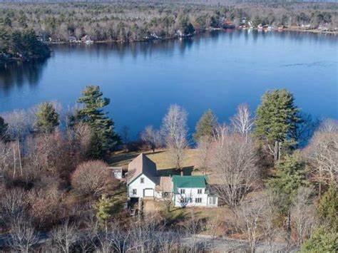
| X | Beach or Waterfront Recreational Area |
| X | Overnight or Day Camps |
| |
| Nearest Ski Area(s): Pats's Peak, Ragged, Gunstock Mountains |
| |
| Other: Northwood Meadows State Park; Antiques |
Economic & Labor Market Information Bureau, NH Employment Security, 2021. Community Response Received 9/20/22